Wellcome Ceremony

Público
  • 22 abr 2021
  • Visto: 10 veces

Closing ceremony

Público
  • 23 abr 2021
  • Visto: 12 veces


Keynotes presentations

Geography: Origin of the Complexity of The Food System

Público
  • 22 abr 2021
  • Geography imposes its barriers. These barriers have hindered and limited the movement of people. They enclose it in an environment with availability and defined characteristics. In this environment you must survive by creating your own food system. Transportation techniques have advanced slowly and have facilitated exchanges between populations. Some of these exchanges have been fundamental in the aspects of food. Globalization and the added effects of climate change have increased migration. New cultural food systems have proliferated in large cities, seeking a balance between purchasing power and satisfaction, which will coexist in certain cases with genuine aspects of traditional food identity.
  • Visto: 21 veces

Shaping the Future of Quality Education in Geography

Público
  • 22 abr 2021
  • Which is the contribution of geographical education to tomorrow's citizens? Which is the profile of the professional who can facilitate effective and relevant learning and is prepared to foster the sustainable development goals, its targets and commitments? How can global citizenship and the appreciation of cultural diversity can be further developed? Which is the road towards a relevant education reaching beyond knowledge and skills to values and attitudes which turn into commitments, informed decisions and are able to inspire active roles in society both at local and global level? Since teachers are key to achieve change and will have an important role in achieving the sustainable development goals, the talk will focus on the elements that can make a difference in the training and motivation of professionally specialised teachers, particularly in challenged areas of the world.
  • Visto: 16 veces

SDGs in the Classroom: GIS Learning Resources and Data

Público
  • 23 abr 2021
  • Our world suffers from serious problems-- environmental, social, economic-- that we need to work on together. The Sustainable Development Goals provide a convenient framework to organize some of the key problem descriptions and goals for improvement. But how can we make a concrete difference? Fortunately, GIS software has matured to a point that its use is easier than ever, it is more accessible in the form of WebGIS, and more geographic data is available than ever before. Multiple online resources are described, that are freely available to classrooms (primary schools to doctoral researchers) around the world, and which can be used to make SDGs less abstract and better connected to real problems that students understand and are interested to work on.
  • Visto: 43 veces


Workshop

Open Educational Resources of Geography from the National Geographic Institute

Público
  • 23 abr 2021
  • The National Geographic Institute website includes an area dedicated to the educational community called Educa IGN, containing more than 50 free and open resources to learn about geography, cartography and Earth sciences, in general. The resources are catalogued by recommended age, type of resource and subject, to facilitate their consultation. The resources are didactic materials, maps, videos and games, and they are recommended for different educational levels: Primary School, Secondary School, High School, University and degrees. In addition, the IGN and the CNIG have tools for creating, consulting and downloading online maps that can be used in the classroom to promote the use of ICT. In the workshop we will go through all the resources from a practical point of view. It is recommended to bring your own device.
  • Visto: 10 veces


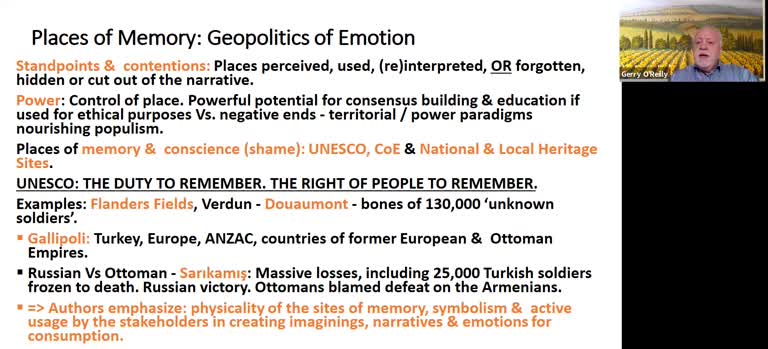
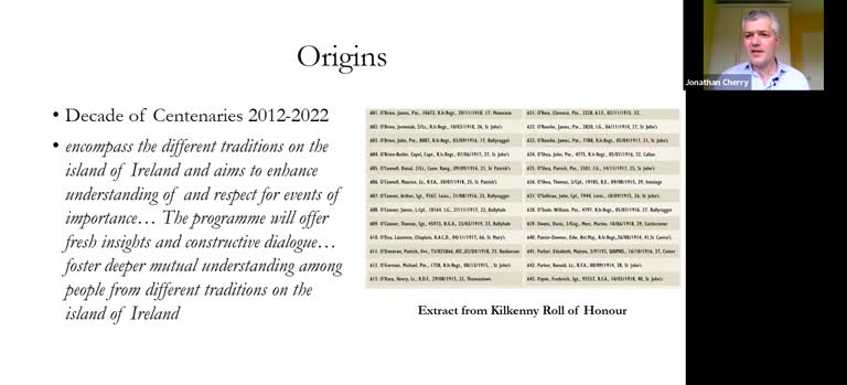
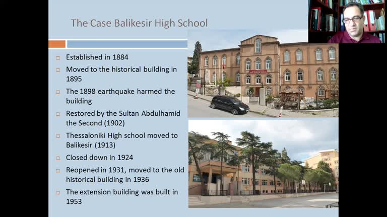
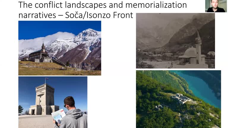
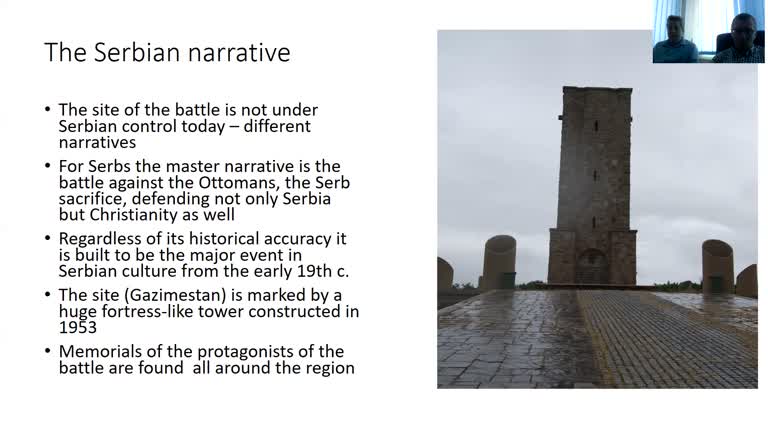
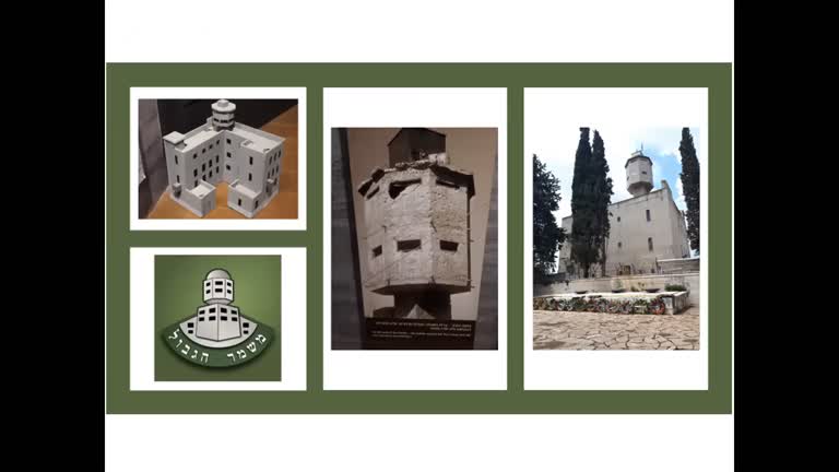
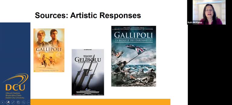
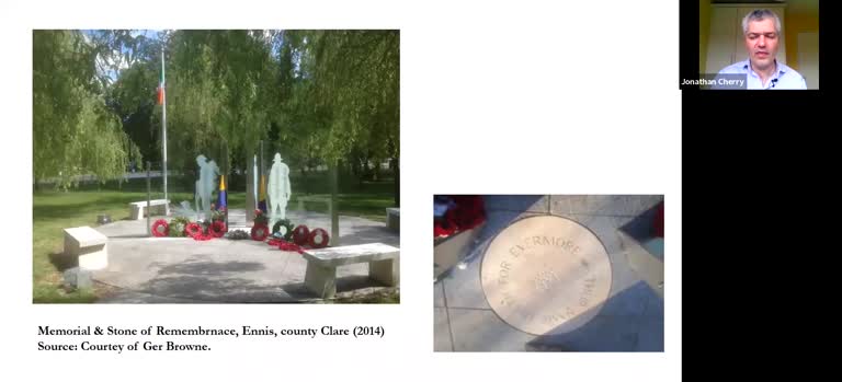
PANEL SESSION: Geography and Memory: Places of Memory and Legacies – in an Age of Insecurities and Globalization

Places of Memory and Legacies – in an Age of Insecurities and Globalization (Trajectory from research to book publication, Springer, 2020)

Público
  • 11 abr 2021
  • Spaces of memory are keystones in shaping the geopolitics of positive or else negative emotions. This presentation unites concepts of place and memory. especially their contemporary significance as with World War One and its legacies still unfolding in cultural and political landscapes. Such places hold a powerful potential for democratic consensuses building and education when used for ethical purposes, or else negative ends vis-à-vis territorial and power paradigms that can nourish contemporary populisms. Working with these concepts, led to a ‘book project’ involving 26 authors from a wide range of standpoints - geographically, discipline-wise, age-wise, culturally and linguistically. This ensured an array of research perspectives and source materials in the original languages. The range of approaches and methodologies greatly enhanced the overall research that culminated in a book publication, supported by EUROGEO and Springer in December 2020.
  • Visto: 18 veces

Nowhere to Pay Our Respects’: Constructing Memorials for The Irish Dead of World War I in the Republic of Ireland, 2006-2018

Público
  • 7 abr 2021
  • Commemoration centred on First World War memorials has been a constant feature of civic life across the UK and many European countries over the past century, however Ireland’s experience is different. While a number of war memorials were unveiled post-1918, their significance as sites of commemoration declined after 1939. However, recent political developments have facilitated a new wave of public commemoration and remembrance expressed through the construction of war memorials. Using case studies, this chapter traces the key agents of remembrance, seeking to establish their motivations in creating these memorials. Other themes include the design and symbolism of the memorials, how they are funded and their ‘geography’ in relation to their siting. In assessing the memorials as foci for remembrance, the chapter concludes that the political nature of remembrance and commemoration continues as it always has, to excite responses and reactions.
  • Visto: 15 veces

Cultural Geographies of Gallipoli: Commemorations and Identity

Público
  • 7 abr 2021
  • The discourses of the past are constructed socially and expressed materially in the Gallipoli commemorations from a cultural geographic perspective. Gallipoli is a place where multiple nations have commemorated antagonistic histories in the same space following WWI. The sanctity of several sites has been reinforced over the years by construction of additional monuments and memorials at the peninsula. This research deals with the spatial aspect of the commemorations throughout Turkey by looking at the intensity of commemorations in different places and times. The published research, memorials and archival materials were examined. while remembrance activities were appraised to determine the significance of the events for the local communities and beyond. Original research places particular emphasis on the schools that have no graduates in their records for 1915, as the final year students went to Gallipoli and never returned.
  • Visto: 52 veces

From the Great War to Interwar Fortifications: Changing Narratives Attached to the Military Landscape in Western Slovenia

Público
  • 7 abr 2021
  • The military landscape of the Slovenian–Italian border region is the result of the First World War and the interwar years. In the study region, which encompasses the western part of present-day Slovenia, fighting took place on the Soča/Isonzo Front, 1915–1917. The front was the scene of one of the greatest battles between Austria-Hungary and Italy. During the interwar period, the region was part of the Kingdom of Italy. During this time, the Italians built fortifications known as the Alpine Wall (Ital. Vallo Alpino). These ran along the new eastern Italian and western Yugoslav border. On the Yugoslav side, the Rupnik Line of fortifications was built to counter the Italian constructions. Trails, monuments, and memorial places are physical reminders of this conflicting past. The narratives attached to these places are integrated into local and national discourses. In the past, major social conflict was associated with these memorials, but now they are being (re)constructed as tourist and hiking destinations. The research focuses on two places of memory in western Slovenia (i) the Walk of Peace trail, a 320 km route connecting outdoor museums, memorials, cemeteries, and other restored wartime sites with stories of the largely overlooked Soča/Isonzo Front, the easternmost section of the WWI Alpine or Italian Front. (ii) The second case study covers a series of memorial trails that run along the interwar border between Italy and Yugoslavia.
  • Visto: 16 veces

Encounters Between Islam and Christianity: Mohács and Kosovo Polje

Público
  • 7 abr 2021
  • Several nations living at the southern and eastern frontiers of Europe fought bitter wars in the 14th to 19th centuries against the Ottomans, which have been playing a significant role in their identity formation. The memories of the battles are deeply embedded in their cultures and are still living today in the political discourses of basic values. Among the battles there are some with European significance and little local/national remembrance, some with both strong national and European memorial impact and some with great local/national but little international recognition. Many of the above mentioned battlegrounds turned to be lieux de memoire in the coming centuries. The Christian communities’ stand against Muslim conquest resulted in the emergence of the trope “Bulwark of Europe and/or Christianity” and the sense of exceptionalism and victimization in their self-images. In our paper we compare two sites from the second group. The meaning of Mohács for the Hungarians is very similar to what Kosovo Polje means for the Serbs. At both places influential memorial geography has been developed, several memorial sites were erected with different narratives. At both places the victorious Ottomans had constructed the first memorial sites and the later Christian monuments are reflections to them. At both places the anniversaries, the public speeches of commemorations, the rites have national political (even multiple) significance. They can trigger strong emotions and can be means of political mobilizations.
  • Visto: 8 veces

Of Borders and Memories, Erased Boundaries in the Land of Israel

Público
  • 7 abr 2021
  • There are many places in the land of Israel that used to be associated with the country’s borders, including sites of memory such as fortifications from all historical periods. Their presence in the landscape and various usage are appraised here from the author’s standpoint regarding the Israeli national narrative. Border lines and their functions have changed over the decades, but their remains and relics can still be seen in Israel. they symbolize history and often have national significance. Hence the major questions discussed are: What is the dynamic of their remaining, or else their disappearance from the landscape? What are the factors playing a part in the preservation of a border after its erasure? A mixture of historical and current borders in the same territory, sometimes with only a few metres between historical and present lines, makes the memories of the past expressive. Memories stemming from the borders in Israel involve personal and national feelings and therefore, they also have a vibrant formal and informal educational significance. When discussing Israel, WWI centennial commemorations bring to consciousness the ending of Ottoman Empire rule in territories in Europe and the Middle East and succeeding geopolitics, the Balfour Declaration (1917) regarding a Jewish Homeland and the blueprint for British and French protectorate rule embodied in the Sykes Picot Agreement (1916).
  • Visto: 4 veces

Inclusive Heritage, Conflict Commemoration and the Centenary of World War One in Northern Ireland

Público
  • 11 abr 2021
  • Visto: 5 veces

Gibraltar: Recovery and Memorialisation of the First World War in the 21st Century

Público
  • 7 abr 2021
  • The centenary of the First World War has served to draw attention to a period in Gibraltar’s history of which limited memories remain. Little has been documented of life in Gibraltar during the War years or indeed, of the support given towards the War effort. At the same time, we know that during these years Gibraltar was managed as a Crown Colony, with a fair portion of its land dedicated to military installations and a key strategic naval base monitoring both the Mediterranean and Atlantic. Such activities have been recorded and have found their way into authoritative accounts of the Great War, ones which contains the Gibraltar story yet renders it liminal if not invisible, submerged as it is beneath the weight of a history articulated solely from the metropolis. This chapter aims at recovering a Gibraltar-centred narrative through the prism of the centenary commemorations, which have functioned as a catalyst for Gibraltarians to enquire into their past. to uncover details of their fallen of which few memories remain, and to reconstruct, albeit from fragments and mediated stories, a history that aspire towards a whole. The disentangling of a local non-hierarchical story from the hierarchical is informed by a recurrent grappling which aims at prioritising a Gibraltarian historical perspective as opposed to one which conceives of Gibraltar only through its relationship to Britain. Underpinned here is a process of historical recovery triggered through Acts of Remembrance that resonate at two levels. commemorations for the First World War, and alongside this, a remembrance of Gibraltar’s own story.
  • Visto: 5 veces

Exploring Places of Memory and Their Legacies: Self-directed Learning, Activities and Questions for Reflection and Revision

Público
  • 7 abr 2021
  • This paper introduces some sources and methodologies which can be applied in order to encourage reflection on a key overarching themes and questions around places of memory and their legacies. It sets the scene by outlining the constructivist approach to learning. Inquiry-based learning is encouraged in order to deepen understanding, with an emphasis on exploring the complexity of the topic and appreciating multiple perspectives. Suggested project work and other practical hands-on activities help to provide a meaningful context for learning. Different types of sources are introduced, including cinema and literature, as well as online newspaper archives and colorised historic photographs. Readers are encouraged to ‘see for themselves’ by undertaking both real-world and virtual fieldtrips (using GoogleEarth). All of the activities are designed to support real engagement with the concepts of memory and commemoration, as well as encouraging the development of a range of different transferrable skills in relation to research and presentation.
  • Visto: 7 veces

EUROGEO 1

Público
  • 17 abr 2021
  • Visto: 20 veces

EUROGEO 2

Público
  • 17 abr 2021
  • Visto: 15 veces


PANEL SESSION: Geographical Naming as Critical Content in Geography Education

Geographical Naming in Northeast Asia: Sustaining Cultural Traditions

Público
  • 23 abr 2021
  • Geographical naming, also known as toponymy, has experienced a renewed interest in geography and other disciplines. Discussions of geographical names have largely been focused on their location aspects in the past and their representation on maps. However, geographical names have also developed into a critical study and research topic when the question arises: "What is in a name?" Geographical names are examined for their ethnic, cultural and emotive elements as well as for their historical qualities and antecedents. This session is designed to present research and pedagogical papers on geographical naming and examples of the critical nature of naming as a topic in geography education.
  • Visto: 4 veces

The Validity of Critical Toponymy Perspectives for an Understanding of Human Perception on Places” by Dr. Sungjae Choo (Kyung Hee University, South Korea)

Público
  • 23 abr 2021
  • The research field of critical toponymy has been formulated as a platform to investigate political elements and power relations involved in adopting, using and changing geographical names. It is argued that critical toponymy perspectives contribute to understanding different identities that are sometimes contested, conflicted or disputed in naming a geographical feature, and thus ultimately diversify the human perception of places. Based on various facets of critical toponymy research, suggested as ‘multi-dimensional critical toponymy,’ this paper examines how different, contrasting or sometimes conflictual perceptions are exposed and developed. Two cases are examined: naming the sea between Korea and Japan; and naming a Russian city Volgograd, which was renamed from Stalingrad
  • Visto: 3 veces


PANEL SESSION: Digital Humanities: Needs and Perspectives

Open Source Geotechnologies for Teaching Cultural Heritage. The Case of Toledo (Spain)

Público
  • 23 abr 2021
  • Geotechnologies occupy an increasingly wide and diverse space in our society. Its implementation in educational environments is growing at all levels, especially in higher education, and in a wide variety of disciplines. The field of Humanities and the management of cultural heritage are some of the sectors where its use is becoming most widespread. The multiple, heterogeneous, and unspecific offer of geoinformation opens up great possibilities for learning and new opportunities for analysis for future specialists in cultural heritage, despite difficulties in both its management and its approach. An exploratory analysis is presented on open georeferenced information sources that facilitate the management of cultural heritage from a spatial perspective. The research is applied to the study of the historic city of Toledo, which is a world heritage site. The study forms part of a European project that aims to value Geosciences in Higher Education.
  • Visto: 15 veces

Travel Experience in the Middle Ages and Story Maps

Público
  • 12 may 2021
  • Current developments in the digital humanities have revealed the importance of digital technologies in higher education. The Esri Story Maps App is a part of Geographical Information Systems designed for delivering compelling stories on various topics combined with digital, interactive maps. The author of this presentation is in the early stage of work on a textbook named "TRAVEL EXPERIENCE IN THE MIDDLE AGES AND STORY MAPS" for history students. Various historical sources, such as ruler's charters, itineraries, travel logs, narrative sources (historical texts, hagiographies), and archive data, transmit multicultural travel experiences related to South-East Europe. Together, they convey critical information on political, military events, and past cultural settings. The textbook will utilize Story Maps' power, creating a synergy of digital and hard copy material for the online and classical teaching process and demonstrating the nature and usefulness of the data mentioned above for historical research. During the Eurogeo conference, we will inform the audience of the project's aims, which include the historical methodology, pedagogical, and technical aspects behind its realization.
  • Visto: 2 veces

Tell your Story. Digital Transformation for Sustainable Development

Público
  • 23 abr 2021
  • The paper focuses on a training course experience on the conscious use of digital technologies for Global Citizenship Education. The course was designed for undergraduate students with the aim of reflecting on the goals of the sustainable development agenda and looking at them as the blueprint to achieve a better and more sustainable future for all. In this framework, teachers prompted students to reflect on whether and how technologies help shape conscious citizenship. Students used a particular technology to tell stories (storymapping), where facts, ideas, and knowledge were always connected to place and space on a map. The possibility of expressing themselves through cartography, a profoundly visual and analytical document, at the same time facilitates students to reflect on the link between human agency and geography. The storymaps produced by students started from specific case studies to highlight the relationship between the chosen sustainable goal and the response of technology (exploiting the potential of teamwork and collaborative learning). The paper examines, through the analysis of storymaps, the students' degree of awareness regarding the global challenges identified by Agenda 2030, including those related to poverty, inequality, climate, environmental degradation, prosperity, education and justice.
  • Visto: 11 veces

Professional Challenges in Digital Humanities: Empirical Insight (HUM@N)

Público
  • 23 abr 2021
  • Digital Humanities is a broad field of research and scholarly activity that encompasses not only the use of digital methods by arts and humanities scholars and the collaboration of Digital Humanities specialists with computer science and science disciplines, but also the ways in which arts and humanities offer particular insights into major social and cultural issues that appeared with the development of digital technologies. The Digital Transformation in Humanities project consortium (HUM@N) conducted research that targeted two worlds: 1) that using digital technology in humanities (or in related fields) in higher education and 2) another working on digital humanities, often not in higher education institutions, or not even in the humanities. It is necessary to deal with both as together they determine, or deeply influence, digital transformation in the humanities. The research aimed to identify the current level and nature of ICT use and the extent of variation, if any, between subject domains. Similarly, we were interested in educational and research activities in the humanities that are supported by ICT, as they are highly interrelated. A Strengths-Weaknesses-Opportunities-Threats Analysis (SWOT) was also carried out to get an overview of the current state of opinions regarding the use of ICT in teaching and research in the humanities. As expected, opinions vary considerably, not only due to the subjectivity of the responses but also because of the objectivities that respondents face in their work.
  • Visto: 11 veces


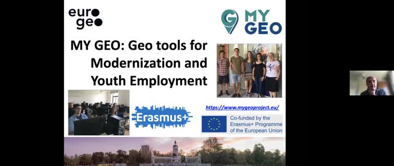
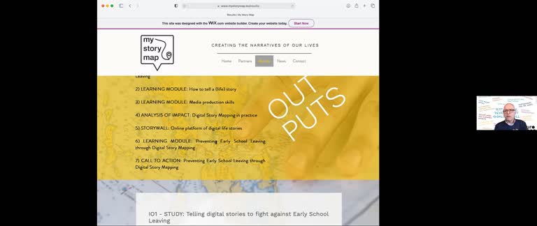
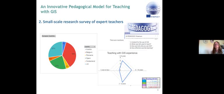
EUROGEO Project Presentations

Geo-projects and Innovation in Education

Público
  • 23 abr 2021
  • Visto: 8 veces

My Story Map: how to tell a life story

Público
  • 23 abr 2021
  • The project "My Story Map" has two main objectives: - To motivate youngsters who have dropped out of education to re-enter their learning pathway. - To avoid early-school withdrawal of students at risk of dropping out. The project started with desk research that focused on two key areas: 1. the current situation regarding prevention of, intervention against, and compensation of early drop-out from education and training in the countries participating in the project (FR, AT, BE, IT, ES) and at European level (progress made within the strategic framework Education and Training 2020) 2. a synthesis of the present state of research on the impact of story-telling and digital mapping on diverse target groups Special emphasis was placed on conclusions and recommendations for the development of the project’s educational outputs. These outcomes form the basis of the learning modules aimed at engaging directly early-school leavers in an educational action as ""digital peer educators"" by implementing digital storytelling and digital mapping with young people, who will produce their life stories through digital maps. The resulting digital products will be organized, enriched with extra related content (such as video, photos, audio messages, etc.) and showcased in an online exhibition, which will be part of a communication campaign (StarWall) aimed at using social networks as a means of dissemination of educational messages.
  • Visto: 8 veces

GI-Pedagogy: Innovative Pedagogies for Teaching with Geoinformation

Público
  • 23 abr 2021
  • The aim of this session is to present the initial findings from work undertaken as part of the Erasmus + GI-Pedagogy project, which is designed to bring Geographical Information Systems (GIS) into the classroom in innovative and effective ways. This has been done by presenting an academic review of existing pedagogies relating to GIS as well as suggesting new approaches for teaching and learning with Geoinformation. This, together with the results gained from a small-scale survey of experienced teachers from partner countries has been used to explore the pedagogical approaches being used in European Secondary schools to teach with GIS, to help to identify examples of best practice. The project aims to provide trainee and early career teachers, with the skills and resources they need to teach with GIS in an innovative and effective way. This presentation will review our initial findings and start to explore possible alternative pedagogical approaches for teaching with GIS. The aim is to develop a suitable framework and toolkit for teachers, together with the resources they need to confidently teach with GIS, and so embed its use in their school curricula. Delegates will be invited to suggest possible next steps for this work.
  • Visto: 22 veces